MBVC geologic map critique #1 – The Edison Ice Cave Flow

This is the first in a series of critiques of the original geologic map by William E. Scott and Cynthia A. Gardner from 1992 of the USGS. The critique will compare their work with available lidar data, and how I arrived at my lidar-derived rendition of their map.

Kwolh Butte Flows – SE Flank near the Edison Ice Caves – mb3c & mb3b

The area I will be discussing in this blog post focuses on unit mb3c. The precise areas I want to analyze are the flow lobes that specifically say “mb3c” within their boundaries as seen below:

mb3c-Edison map

Those two light purple lobes explicitly labeled as mb3c are our main focus, and the northern portion happens to be the location of the Edison Ice Caves (visible in a faint red text).

In lidar, the map area shown above, looks like this:

mb3c-Edison lidar

For those not comfortable analyzing lidar DEMs, it can be a little overwhelming. Especially when it’s of this quality – an almost metallic look, with a tendency to be a bit exaggerated in this example. Not all lidar DEMs are created equal.

What I’ve done in the next image is taken the 1992 map, placed it over the lidar image, and then traced over their lava flow boundaries, replicated their symbology, and done away with the rest. That way, we can only see what we are concerned with: how their flow constraints match up with lidar.

mb3c-Edison lidar overlay

Overall, their work is not bad for pre-lidar and pre-GPS days. An effort to be commended. Closer examination, however, reveals some flaws though. I’m going to drill down to where that red dot is located to get a closer look. That red dot follows us to the next image. It’s still located in the same spot though.

mb3c-Edison lidar closeup

Okay, so you should see the red dot up in the NW quadrant of the image. The flow it’s located in was originally labeled as mb3c. You can identify the flow by it’s knobby texture. It has a lumpy quality to it doesn’t it? You can’t see very many lava flow features that would show the direction of the lava flow such as ogives or corrugations. To help you see the exact boundaries of the flow, I’ve outlined it in orange in the next photo. The lava flow I’m analyzing is within the orange lines.

mb3c-Edison lidar closeup boundary

In the 1992 map, adjacent and to the west of this flow, an older flow was identified as mb3b (a darker purple).

mb3c-Edison map orange dot

In the above picture you can see that dark purple flow (mb3b) just west of the red dot. This mb3b flow was supposed to be older than the flow we’re concerned with. But if you look really closely in lidar and examine that flow, you can see mb3b overlaps the flow confined within the orange lines. I’m gonna drill down a bit more where that red dot was to show you what I’m talking about.

mb3c-Edison lidar closeup arrows

In the above photo, the red arrows are hovering above, and pointing to the edge of the mb3b flow. The mb3b flow is overlying the allegedly younger flow that was originally identified as mb3c. The green arrows hover above and point to an even younger flow that is also identified as mb3c, except this time, accurately identified by Scott & Gardner as far as we know.

mb3c-Edison lidar closeup Edison

In the above photo, we’ve moved to the north to examine more of this same lumpy flow outlined in orange. The Edison Ice Caves (cyan arrow) are seen close to the center of the image as a series of sinks just south of a younger and narrow lava flow that divides the “lumpy” flow outlined in orange.

I won’t go into detail with this area, but it too is overlain by younger mb3c flows, and I’ve already established that this unique flow is older than mb3b.

Finally, I will compare the newly identified flow’s orange boundary with the original 1992 flow boundary in black:

mb3c-Edison lidar overlay comparison

The red dot from the previously reviewed area is visible, and the Edison Cave flow area is outlined to show you how it compares to the 1992 mb3c flow boundary. The orange flow occupies nearly all of that territory, though misaligned at the north boundary, and missing the narrow lava strip that runs through the middle of the orange-identified flow.

So what is this orange flow exactly? We’ve concluded that it’s definitely not mb3c because it’s overlain by the younger mb3b flow. That leaves us with at least a couple of possibilities. Mb3a, which is not depicted on the 1992 map portion I selected, is the prime candidate. While it is on the other side of the Mount Bachelor Volcanic Chain, it features a lot of the same qualities: a knobby, lumpy texture, and lacking distinct flow characteristics like ogives, channels or levees. It originates from the vicinity of Kwolh Butte as does this flow. In areas where it is confirmed on the 1992 map, it is a widespread and significant flow, and it’s possible that it flowed in the Edison Ice Caves vicinity as well. That’s my lidar-derived conclusion: mb3a!

It could be an entirely new flow too. Lidar analysis can go only so far. It’s not chemical analysis or paleomagnetic work. It’s just another tool in helping constrain lava flow boundaries. If nothing else, lidar-based analysis helps identify key areas of interest that require geological science to give us the bigger picture.

In my lidar-derived geologic map, I decided to tentatively label this new flow as mb3a and it is depicted in a dark purple. I’m concluding this critique by sharing the same area from my lidar-derived map for comparison to the 1992 map.

mb3c-Edison lidar map

And again with a transparency showing lower resolution lidar underneath.

mb3c-Edison lidar map transparent


Mount Bachelor Volcanic Chain and Geologic Map

Over the course of seven years I’ve been working on a lidar-based geologic map of the Mount Bachelor Volcanic Chain (MBVC). The first version was released in the 2019 NCA & Western Region Guidebook on August 31st.

The map is based on the 1992 USGS map by William E. Scott and Cynthia A. Gardner. My map would not have been possible without their geologic science. Or at the very least, it would have looked very, very different. Scott & Gardner went into great detail identifying and constraining the lava flows of the MBVC. And my map is meant to be used in conjunction with theirs. My map is based on lidar interpretation, and it shares the same lava unit identifications as Scott & Gardner. If you’re looking for more information on what is being identified, refer to their map first.

While a geologic map, on its surface, has very little to do with the “subterrain” of central Oregon, it does allow for figuring out where a good spot for lava tubes may be, especially if you know where existing ones are distributed.

The 1992 USGS map has some areas that weren’t fully constrained, and in my analysis of the lidar, I’ve cleaned up some of those uncertain areas, but in the process I’ve also identified new areas of uncertainty.

Some of the notable additions to the map are newly identified vents, cinder cones, faults, lava flows, and expansion or reduction of existing flows. Most importantly, the lava flow constraints are now highly accurate, whereas past constraints were based mostly on topography and they didn’t have GPS technology to get accurate locations for their paleomagnetic sampling. To that end, a few flaws have been discovered, but most of the ambiguity of their constraints have been done away with.

A bit of new symbology was also created. When you are dealing with lidar, you can be as accurate as you need to be. Sometimes being too accurate can slow you way down and be a detriment. But in favor of accuracy, individual flow lobes have been drawn in, necessitating a need for symbology like the “discontiguous” arrow that shows two separate flows are related but separated by a younger overlying flow.

Typically in lava flow maps, “Y/O”s denote lava flows sharing a boundary by labeling them as younger or older, or “Y” and “O” respectively. With the high accuracy of lava flow constraints on a lidar-based map, I found a need to introduce a third symbol: “C”. The “C” stands for contemporaneous, meaning those lava flows were formed relatively at the same time, at least geologically speaking. There are very few examples where this is needed, but there are a few instances where a flow has been identified overlapping another flow, only to have that flow overlain by the previous.

Another symbol that was created was the “rafted break” symbol to depict sections of a flow lobe that separated and traveled downhill. In future versions of the map, there may be another new symbol introduced for “breakouts” where the toe of a lava flow is punctured by the internal lava and extrudes forming what appears to be an entirely new flow with different texture.

There’s also the issue of identifying lava tube entrances, because they are key in determining the location of the conduits that funneled the lava of the flows. So far the versions of the map I’ve produced don’t have cave locations, and I haven’t found an acceptable way of introducing such a version to the public that satisfies both the need to depict the location of these conduits, but also maintains their inconspicuousness. Cavers, you see, are concerned with keeping caves secret because many caves have suffered from vandalism in many shapes and forms.

The finer details of what has been changed from the 1992 map are described in the 2019 NCA & Western Region Guidebook. Perhaps they will be published here in the future if the map is discussed more. For the most part, this map is finished, though a few minor changes will be made, and have been made since its original publication. Future versions will be released that depict these minor variations. As Scott & Gardner before me, this map definitely has errors, deliberate or not.

I hope people enjoy the map as much as I’ve enjoyed making it. The image provided below is a low resolution version. This map is copyrighted ©2019 by Matt Skeels.

Mt. Bachelor Volcanic Chain version 1.0 Large Thumbnail

Arnold Ice Cave Pilfered


Arnold Ice Cave

A wonderful thing happened in the summer of 2010. Arnold Ice Cave changed from an inaccessible and boring footnote of the caves of China Hat road, to a long, beautiful, and historically interesting cave. Well, I guess Arnold Ice Cave was always historically interesting, but only in a hands-off sort of way. You see, for the better part of of the last century, Arnold Ice Cave was full of ice. In fact, by the 2000s it had so much ice that you couldn’t get into the cave. The ice had effectively filled it up and sealed it shut.

In the 1920s and 30s, miners harvested the cave’s ice after Hugh O’Kane cornered Bend’s ice market. The late 1930s were the last time anyone entered Arnold Ice Cave’s “Boys of Bend Extension” and it was only accessible because of the ice mining operation. The miners had removed so much ice that it allowed explorers to access what was then, a new extension of the cave. Soon after, the cave slowly began filling up with ice. Before long, only the entrance room could be entered. The wooden stairs that were installed by Deschutes National Forest in 1963 were eventually swallowed up never to be seen again, and so too the rest of the cave. That is until the summer of 2010.

July of 2010 was… interesting, to say the least. A pair of young adventurers attended an Oregon High Desert Grotto meeting. The meeting went as planned until the couple discussed their visit to Arnold Ice Cave. They nonchalantly talked about exploring a tight crawl and traversing over thousands of feet into the cave, noting old items in the cave such as an empty cigarette box that “disintegrated on contact.” The members of the Oregon High Desert Grotto couldn’t believe their ears – Arnold Ice Cave was sealed off with ice! Certainly, this couple must have mistaken it for some other cave (anecdotally, one of the Grotto’s members, Ted Hasse, had visited Arnold Ice Cave a week or two prior to the young couple and found the cave still inacessible). They insisted it was Arnold Ice and were pretty clear in their description that it merited further investigation.

That very evening, a small group of cavers from the Grotto drove straight to Arnold Ice Cave. If the report was true, it meant the rumored extension was open! As with all things on China Hat road, time was of the essence. When things get into the hands of the public, the sad truth is, they tend to destroy things. As you will read, Arnold Ice Cave was no exception. This is why cavers are so secretive about cave locations!

The cavers arrived at Arnold Ice with all the necessary gear. They discovered there was a small hole in the ice-choked entrance and it lead to a 12 foot drop. I was on this trip and I was unprepared to be dumbfounded. The four of us, Brent McGregor, Lonnie Seiders, Jeremy Wendelin, and myself all rigged up and dropped down the hole. We were now in the remains of the historical ice mining chamber. We stood at the foot of an ice wall that was once an advancing ice sheet that had previously sealed the cave. Slabs of a wooden structure were spotted and were quickly determined to be the remains of the stairway, now completely obliterated. The cave passage loomed darkly.

Lonnie Seiders dropping the vertical ice wall.

Lonnie Seiders dropping the vertical ice wall.

Our group explored the chamber finding items from the first half of the 20th century. McGregor took pictures and would eventually make several return trips to document everything. At the end of the mining chamber, large deposits of ash were a foot thick and we did our best to avoid them and advanced to the end of the room. We observed a small gap between the wall and the large pile of rocks that blocked our path. It was the only way forward, so one by one, we all made the 20 foot crawl and popped out into a small room on the other side of the rock pile.

No modern caver had been beyond the breakdown choke in 75 years. Previous maps of the cave only noted the historical mining chamber. But it was true, Arnold Ice Cave continued on, and we could see the darkness beckoning. As a caver, this is what you live for: virgin passage. While not quite virgin, this was real, real close. Only a handful had been before us. Our feet carried us over the piles of loosely settled rock until we came to what cavers call “original passage.”

Original passage is any lava tube passage that is devoid of piles of rock that broke free from the walls and ceiling. Original walls and ceilings are smoother and sometimes look metallic, especially when highlighted with drip water. The original passage in which we found ourselves was impressively tall, but not unexpected for an Arnold System cave. Arnold Ice Cave was huge! And it kept going! The cave is long for a central Oregon cave and an eventual survey by Geoff MacNaughton and I brought the total length to 2,638 feet.

Suffice it to say, our group had a blast exploring Arnold Ice Cave that evening. We found lots of cool and interesting things and kept finding them on return visits. One of the coolest things we found was the skull of what we assume is a wolf. It was found in the “Original Skull Passage.” I made the discovery when we were slowly looking at everything in the cave. It was in plain sight, but the skull had aged in such a fashion that it took on the color and look of all the surrounding rock. It was lying at the foot of the wall on the floor. It was perfectly camouflaged, or so I thought. I alerted Brent to the discovery, and we took pictures in situ. After some discussion, we decided to pick it up and take a full set of pictures of it from all angles. I’m glad we did, because today that’s all we have left of the skull.

All that is left of the "wolf skull" are a few pictures like this one.

All that is left of the “wolf skull” are a few pictures like this one.

Within a month or two, as the public learned that Arnold Ice Cave was again accessible, they began visiting it in droves. When Brent and I had done the ethical thing and put back the wolf skull for future study, we thought we were doing the right thing, and we were, but unfortunately there is nothing you can do about the uneducated and selfish who would take that opportunity for themselves and deprive the rest of us. You see, because that wolf skull has been stolen from the cave, we can no longer learn about it. No one can see it and admire it. That skull was worth so much more inside the cave than it is outside. The context is lost. I wouldn’t be surprised if that skull has deteriorated and sits in a box in someone’s garage, or its academic potential lost as it sits on a bookshelf, its future unrealized.

But there is a small glimmer of hope that the person who took the skull may be reading this story. If so, or if you know the person who did, I would urge you to contact me, so we can find a proper home for this skull. Clearly, the skull is not safe in the cave. We could find a home for the skull where it could be appreciated by everyone and studied by scientists who could add to our collective knowledge about it and our surrounding landscape. I think we could look past these mistakes and be thankful that the skull could be returned to the public, because really, that’s who owns it. This is a part of our history and it would be a shame if it was lost for good.

Grotto members travelling through the now heavily spraypainted crawlway.

Grotto members travelling through the now heavily spray painted crawlway.

That was not all that was lost from Arnold Ice Cave though. In those first weeks of access, McGregor photo-documented many of the items found in the historical mining chamber. Things like axes, hub caps, flash cubes, old beer cans, and more. All of these items were antiques and now they’re all gone. Removed one by one to enter into personal collections. That large ash deposit that was a foot thick when our caving group encountered it? It’s been trampled flat by hundreds of feet since then. New graffiti has popped up all over the cave too, some as directional arrows indicating the way out, as if a linear passage wasn’t straight forward (pun intended) enough.

An axe that was buried in the ice. It was also pilfered.

An axe that was buried in the ice. It was also thieved away.

Today, Arnold Ice Cave is becoming much like the other caves of China Hat road. I typically get asked by the common folk why all the caves are gated and they express their discontent at losing access to the caves. The truth is, the general public doesn’t take care of the caves. I know that is not true of everyone and generally it’s a “few bad apples” that ruin it. The bad apples that frequent China Hat road love to litter, deface, vandalize and some are willing to go so far as to kill cave inhabitants such as bats. Recall in 2011 the Hidden Forest Cave incident, where a group of young adults ran roughshod over the cave and covered up native American art panels with spray paint.  All for a few moments of glory.

Americans are an interesting lot. Our culture, unlike that of the Europeans who respect caves and openly reveal cave locations to everyone, is in stark contrast. We want it all but zero of the responsibility. We are at the late stage of the game where there are so many people now, that it is effectively easier to manage a cave by gating it, than it is to educate every single person in our community indefinitely. The latter is much more difficult because it’s a never ending process. Each successive generation needs to be taught how to respect the environment. I’ve said it before and I’ll say it again: convenience breeds a lack of respect. We will never be richer until we learn to deal with our own ugliness. It’s a shame, but for now, that seems to be par for the course.

Special thanks to Brent McGregor for supplying photographs for this article.

The most dangerous cave in central Oregon

There is a cave just a few miles from Bend, that I feel is the most dangerous cave in central Oregon. Not because it’s the most likely cave to get killed in, like say by falling down a 100 foot pit. No, it’s dangerous because the cave is deceiving and can lure you in easily, when you may not have the faculty to get back out.

Thimble Cave is a very small, two-chambered spatter cone cave. It’s a part of the Horse Lava Tube System. It was named Thimble Cave because the cave is so small, you could metaphorically put the amount of cave passage it contains into a thimble.

Image

Entrance to Thimble Cave


The photo above doesn’t show scale very well. That clump of grass is next to a foot and a half wide skylight that marks the only passable entrance into the cave. You drop down about 2 feet into a small bubble-like room filled with detritus. It’s pretty non-descript, except for the alluring hole in the floor along the southern wall.

Image

The portal looking into the lower chamber.

It’s a small hole, much like the entrance. It’s about a foot and half in circumference. On my first exploration of the cave I was by myself. I saw this hole in the floor and peered in with my headlamp. It appeared to drop down almost 6 feet into a standing room chamber that I couldn’t quite see entirely from my vantage point in the upper chamber. It was risky, but I wanted to explore the room, so I stuck my feet in the hole and slowly slid down into the lower chamber.

The last bit into the lower chamber was a little sketchy because I had lowered myself as far as I could without letting go and still hadn’t touched the floor with my feet. But I knew I was definitely close, so I made the plunge. I let go and dropped perhaps several inches to the floor. It was spongy. Once I gathered myself, I inspected the room with my light and saw that the entire floor was composed of pine needles, pine cones, and dirt. A small pile of needles had accumulated underneath the portal to the upper chamber. I knew I was going to have some difficulties getting out, but I was going to wait for that until after I had explored the new room.

It was cozy, comfortable, and not terribly exciting. A small feeder tube that had closed shut during the formation of the cave showed signs of remelt, but aside from that, not much drew the eye, Well that is except for the couple of emaciated frogs on the floor. I found them alive but in very poor condition. Skinny from starvation because they had fallen into the cave and could not make their way back out. This was a sign of how dangerous this cave is, even for a monkey like me. I scooped up the tree frogs and went back to the portal and placed them up on the ledge so they could find their way out.

Now it was time to exit the cave. I initially made a non-serious attempt to climb out and see what type of handholds I had. Not much. It was a nearly vertical drop. It had just enough of a ledge for your chest to rest on, if only you could pull yourself up to it. My first attempt immediately showed me that I could not get out without a boost. I just didn’t have enough strength in my wrists and hands to pull myself out along the abrasive lava rock to get more leverage with my arms.

So I began to pile up a perch to stand on using what little was available to me. There was already a small pile of pine needles, so I reinforced it by placing more pine cones in it, and to my surprise, a couple of small buried rocks nearby. I piled them as high as they would go, maybe a foot tall. After having rested for a few short minutes, I made my attempt to escape. I stood atop the pile I had made and to my dismay they compressed and shrunk under my weight. I knew the longer I stayed on the pile, the less reach advantage I would have, so I immediately reached for a small handhold and heaved myself up as far as I would go. It wasn’t much of an advantage having that pile underneath me, but in retrospect, just enough. It gave me a few more inches to work with.

I was on the portal ledge struggling with my hand to find purchase, with my chest partially resting but not fully. It wasn’t like I could rest there and wait until I had more energy. I had to make a go of it now or I would have to drop back down and try again later but with less energy. I went for it. Pulling myself up inch by inch. It was an incredibly difficult task because my legs had no footholds whatsoever to help push me up making it an entirely upper body effort. To make matters worse, I was pulling my chest over a narrow, partially slanted slot that was abrasive and was catching on my light jacket.

Image

A map to Thimble cave. Top part of the map shows the upper chamber with the two small skylights. The lower part shows the lower chamber and the 5 foot drop (squared) and the 5-foot ceiling height (circled).

After a couple minutes of greatly expended energy, I had managed to pull myself up just enough to allow my chest to rest in the narrow chute-like slot. My feet were still in the lower chamber dangling in open air, while my arms loosely held on to their holds. All the pressure was on my chest. Once I was rested, I scrambled to find more handholds but they were few. Sometimes only enough for a finger. It was piecemeal work maneuvering through the hole inch by very slow inch. The lava created a lot of friction against my jacket and I lost a button in the process. Eventually, I was able to pull myself out with great effort and plenty of well earned abrasions along my torso.

I must have been 26 when I explored that cave. In my top physical prime. A year or two later, I revisited the cave, because I had to survey it to draft a map. I knew I was in for a difficult time. However, this time I brought my 6 year old son who would remain on the surface by himself with my phone in case I had an emergency. I also packed in a couple of football-sized rocks to help me get out.

It was the same experience all over again. The rocks I had dragged in added very little to my reach because the ground kept compressing. Still, I managed to exit the lower chamber with yet more abrasions and a job well done.

A word of warning: I was in the best physical condition in my life when I entered that cave. I was also very skinny at a meager 150 pounds. Were I to try it today a little over a decade later, I would get stuck. I don’t nearly have as much energy as I once had. This cave, even among cavers is pretty much untouched. As far as I am aware, no one other than myself has explored it. If you are going in, chances are you may not be coming out. Those frogs are a dire warning to those would be explorers. If you go caving alone (which I don’t recommend), remember to leave a note detailing where you are going and when you will be back.

Yo yo!

“Yo yo!”

Those are the words you like to hear while looking for caves with your group. Yo yo means that you have found a cave and you are declaring your location for others to find you.

When a group of individuals are operating in a forest with a couple hundred feet between them, this simple technique conveys everything you need. First, it draws attention to the fact that you found a cave. Second it allows everyone to locate you if you are out of sight and to begin heading your way. Everyone knows they can abandon their search and can focus their efforts on hiking toward the shouts of “yo yo!”

“Yo yo” is actually a part of another term used by northwest cavers. Namely, the singular “Yo!” One “yo” announces your location, or can be used to ask for another’s location. For instance, if I’m a little turned around while hiking in the forest, I can shout “yo!” to my out-of-sight companions to ask for their location. In return, they shout “yo!” and from there you can determine if you need to change your direction or meet up with the other cavers.

Yo, and yo yo have been adopted by the Oregon High Desert Grotto, (the local caving club of central Oregon) many years ago. They borrowed it from the Willamette Valley and Oregon Grottos who are believed to have originated the terms. It is unknown as to the current spread of the terms, but they are still being used by all grottos of Oregon.

LogCrib

Log Crib Cave took a couple “yo yo’s” to relocate.


Bend’s Lost Cave

A couple years ago, I published a technical article in issue 29 of the Oregon Underground newsletter. It was about Brogan’s mention of a “lost cave” in Bend. It was thick with references and not easy to read. This blog post will take another approach in exploring the possibility of a lost cave in Bend. Phil Brogan, a historian of Bend among other things, wrote about a lost cave in a 1941 issue of the Oregon Journal. Here’s what he had to say:

“In east-side Bend, on or near the old L. D. Wiest property, there is a ‘lost cave.’ When Bend was a pioneer town, this cave had a big opening. Because such an opening was dangerous, it was closed with rocks and carefully covered with dirt, old timers say. And now, not even the old timers know the exact location of the cavern. But occasionally there is heard under the earth dull thuds, probably loose rocks falling from the roof of the lost cave.”

Now there is a tempting morsel! To my knowledge, this single paragraph is the only original documentation of a cave located on the east side of Bend. By the east side of Bend, Brogan is describing the Wiestoria property roughly between NE 2nd Street and NE 12th Street north of Greenwood Ave.  This historic Wiestoria is not to be confused with the new Wiestoria development property at the corner of 8th and Revere, though it does fall squarely inside the historic Wiestoria.

So Brogan says this lost cave is squarely in the center of good ‘ol Bend! Any cave in the vicinity of Wiestoria would be a part of the flow that created Lava River Cave, or a small lava flow that issued from the northwest flank of Pilot Butte. There is a small chance that the cave is related to the fault scarp that runs through Wiestoria, but typically these scarps are oblique-slips, which is to say, they are a combination of fault boundaries moving horizontally and vertically against one another, but it’s uncommon to have the boundaries of these faults shift away from another to leave a gap.

And what’s this about “dull thuds?” I suppose this cave periodically would have a rock dislodge from the ceiling and fall to the floor creating a loud booming noise. No one I’ve spoken with has heard this sound. I personally feel that the occasional “dull thud” being heard is too often an occurrence for a cave that has lasted around 100,000 years. At that rate, I would think the cave would have dismantled itself by now. Perhaps these rocks were falling off from an increase in water erosion caused by the settlement of Bend? In that case, it may be that in the next 100 to 500 years, this cave may open itself up again. If it exists at all.

There are a ton of anecdotal reports on caves on the east side of Bend. Too many to list here, but a few of the noteworthy ones include:

  • a cave off Brinson Blvd in the industrial section and since been built over (probably a fault cave) has been noted by two unrelated residents
  • a lava tube east of Pilot Butte Middle School near Cliff Dr (estimated to be about 100 feet long) has been noted by two unrelated residents
  • a possible cave underneath St. Charles hospital discovered during test drilling or excavation
  • a fault cave off Full Moon Dr that was used to funnel treated waste from the old treatment plant (hence the inside joke “Full Moon.”)
  • a dubious report of a cave underneath or near the intersection of Penn Ave and NE 12th St, but noted by three unrelated residents
  • a bootlegger cave reported south of East Hwy 20 near the intersection of Bear Creek Rd and Purcell Ave (more on this in a later blog)

If you have any information on caves in the city of Bend, especially in the historic Wiestoria area please contact me. Confidentiality is always respected.

Essential cave literature for the beginner

This blog post will focus on essential cave books that everyone new to central Oregon caving should read or own. These books are primers for becoming familiar with central Oregon’s most popular caves. Anyone with a hint of curiosity about the area’s lava tubes will enjoy these books and find plenty of facts and history to absorb. The last section discusses harder to obtain guidebooks. They are usually handed out at regional caving events and paid for during registration. The camaraderie and good times had at these events are priceless.

Lava River Cave

Lava River Cave by Charlie Larson

Lava River Cave is a book dedicated to Oregon’s only commercial lava tube. It’s a slim book at 24 pages long, but Larson has undervalued his books so they are dirt cheap to pick up new at any retailer that carries them. Larson’s book on Lava River Cave is great for its history and old photos on the Sand Gardens, tunneling, and two maps. One map shows the entirety of the cave on pages 6 and 7. But the other map is segmented over the continuing pages and is described in great detail by Larson’s descriptive and methodical words.

This book is great for what it is, the only in depth literature on the cave, and a collection of history and photographs from decades past. Lava River Cave can be found for sale at the Deschutes National Forest office on Deschutes Market Road in Bend, the High Desert Museum and Lava Lands Visitor Center, both south of Bend on Hwy 97.

Central Oregon Caves

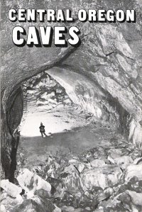
Central Oregon Caves by Charlie Larson

The other great book by Larson that is still available for purchase is Central Oregon Caves. Its main focus is on the public caves of the Deschutes National Forest with inclusions of a few BLM caves, a few caves from Willamette National Forest, and two privately held caves for completion’s sake. Like his other book “Lava River Cave,” Larson describes the caves in detail, but because of the greater selection included, each cave has a limited amount of space. This really isn’t a problem since you will want to explore and discover most of these caves for yourself. This book is chock full of goodies you shouldn’t pass up. Most of the caves have maps for them and those that don’t probably have a picture or two. Larson continues his geological review of the caves and you’ll find plenty to sink your teeth in.

Since the book’s creation, a lot has changed for the most notable caves of this book. Skeleton, Wind, Charlie-the-Cave, and Stookey Ranch Caves have all been gated in an effort to restore and manage the bat populations there. One thing that is not clear from the description of Stookey Ranch and Charcoal Cave no. 2 is that they are privately owned. Even though the gate design of Stookey Ranch is the same as others nearby, it’s still private property. If you find yourself staring at either caves without permission, you’re trespassing. Just an FYI!

Larson has had a huge hand in educating the public about these caves and having cultured more than a few cavers from his literature, including myself. His books are fantastic, cheap, and this book in particular should be your starting point. Central Oregon Caves can be found for sale at the Deschutes National Forest office on Deschutes Market Road in Bend, the High Desert Museum and Lava Lands Visitor Center, both south of Bend on Hwy 97. Pick this one up!

Geology of Selected

Geology of Selected Lava Tubes in the Bend Area, Oregon by Ronald Greeley

This little gem of a book is no longer for sale and hasn’t been for some time. It’s actually a geology book released by the State of Oregon’s Geology department in conjunction with the Space Sciences Division of NASA. This book can be read at the Central Oregon Community College’s library or accessed by inter-library loan through a public library. The book is meant as a study of domestic lava tubes for use toward lunar analogies, perhaps lunar bases in the future. But it reads fairly easily and has plenty of pictures and maps to entertain any cave enthusiast.

The book should not be used as a cave guide for exploration. Greeley has detailed a few caves from the Horse Lava Tube System that are on private property. There’s nothing like traipsing through people’s property to get in trouble with the law. So think of it as a vicarious look into those caves which are now out of reach. But fear not reader! This book has plenty of information on the Arnold Lava Tube System and other popular caves on public land like Lava River, Skeleton, Boyd, and South Ice Caves. Like Larson’s book, Greeley doesn’t note that some of the caves are on private property and this includes Charcoal Cave no. 2 and Stookey Ranch Cave.

CavesVolcanicLandforms

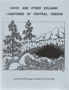
Caves and Other Volcanic Landforms of Central Oregon by Lynne Sims and Ellen Benedict

This book was still available for purchase in some locations like the Deschutes National Forest offices only a few years ago but those copies may have been leftovers from the 1982 NSS Convention. Still, it’s easily acquirable through inter-library loan or perhaps even on Amazon, eBay, of Half.com from time to time. This book takes a different approach to exploring caves and the countryside. Most of the thrust of the book is on using car mileage to establish a route through the landscape to view volcanic features. Features reviewed in the book range from the Newberry lakes to Crack in the Ground to Derrick Cave. The book is illustrated with photos and artistic renditions of cave inhabitants like the elusive grylloblattid or harvestman to surface fauna like coniferous trees and chipmunks.

Harder to Obtain Literature (and some not so essential)

1982NSSGuidebook

An Introduction to Caves of the Bend Area, Guidebook of the 1982 NSS Convention edited by Charlie Larson

This is the holy grail of local cave literature. The guidebook was specifically made for the 1982 NSS Convention that was held in Bend at the Mountain View High School. Most of the material was written by Charlie Larson, but credits also include Larry Chitwood for the geologic map and geology section, and Jim Nieland for the cartography though not all of the cave maps were done by him. Some contributions from Ronald Greeley and Craig Skinner are also included.

The 1982 guidebook is extremely difficult to come by now. It is sold out everywhere and has been for many years. A copy of it was available through the public library but it was never returned some time ago. The book doesn’t turn up on the auction sites or online booksellers. The best option currently is to know someone who has it and borrow it, or get a photocopied version.

Larson went all out on this book and packed in many caves found in his other book Central Oregon Caves and a whole bunch more, especially on less popular caves that you know are just nearby, but you’re not quite sure where. This book doesn’t help you find the caves since that’s not the intent, but it does give maps and descriptions for Button Springs, McKenzie Pits, Santiam Pit, the Matz Caves, Edison Ice Caves, Cleveland Ice, and many other caves that are sure to knock your socks off.

My personal favorite is the section on the Horse Lava Tube System which I have spent many a day studying and visiting with landowners. Aside from grotto newsletters, this book is one of the few sources of information on that system and the maps supplied sure do peel your eyelids back as you realize these caves are all near the city of Bend.

GuidetoLavaTubes

Guide to the Lava Tube Caves of Central Oregon by David Purcell

Okay, so I know I titled this blog post as “Essential cave literature…” but I couldn’t help but mention this little book. It predates all the other books by Larson and has much of the same format as his book but less finesse. You won’t learn much more from this book than you will from Larson’s books, however it does include a little bit of information on Malheur Cave and the lost Crystal Cave. Guide to the Lava Tube Caves of Central Oregon is no longer for sale either, and your best bet is to hunt it down online.

2003WesternRegional

Pushing Passage at the Western Regional 2003 edited by Patti Williamson-Hughes

This guidebook was released in limited quantities to attendees of the 2003 Western Regional. Its intended destination was not for the public of course, but it’s worth mentioning to anyone who has more than a passing interest in local caves. The guidebook is slim and the production values are low, yet it packs a small punch with its collection of cave descriptions and maps. Most of the entries in this guidebook are not found in the previous books described above, and a few like Carburetor Cave are not found in any other book [Ed: Now found in Basaltic Bourne guidebook (see below)]. For that alone, it makes it worth a look.

2010RegionalGuidebook

Undiscovered Country, 2010 NCA Regional Guidebook edited by Matt Skeels

Edited by who? That would be me. Now I get to play the part of a self promoter. This book was created for the 2010 NCA Regional. Roughly 80 copies were made and they’re all gone now and in the hands of cavers. Much like the 1982 NSS Guidebook and the Pushing Passage 2003 Guidebook before it, I attempted to make it a collection of cave descriptions and cave maps. Many contributors helped in making this guidebook come to fruition including Charlie Larson, Brent McGregor, Jim Nieland, Ella Rowan, Larry King, Ric Carlson and plenty of others.

The most unique contribution to the guidebook are the maps and I created this book to be the “one stop shop.” Brimming with obligatory cave maps, revised maps, and new maps the most noteworthy of which is Arnold Ice Cave. Revised maps of Lavacicle and Skeleton Cave are also included, as well as rare inclusions of such caves as P Line Ice, Upper Breezeway, Cody Borehole, Parker, and many others. One of the shortcomings of the book is the low number of articles, but the 74 cave maps included outnumber the total number of pages in the book!

2015RegionalGuidebook

The Middle Ground, 2015 NCA Regional Guidebook edited by Matt Skeels, cover photo by Brent McGregor

Like its predecessor, Undiscovered Country, this book was published for attendees of the 2015 NCA Regional event held in Bend, Oregon and hosted by the Oregon High Desert Grotto. If I recall correctly, about 120 copies were printed up. It also checked off the box of having Neil Marchington on the cover. I had originally meant to get him on the cover of the Oregon Underground, but the right photo never materialized before I had stopped working on the newsletter.

The book took shape much like UC, in that the goal was to cram as much maps as possible and make it the one stop shop again. To that effect, this book has nearly everything UC does, plus a whole lot more. Nearly double the pages! One of my last communications with Larson before he passed that summer was making sure I still had a greenlight to use his material for this book which he graciously obliged. Other content providers include Steve Knutson, Brent McGregor, Larry King, Liz Wolff, Tom Kline, Jim Nieland, myself and others. There are a few minor errors in the book. I threw this thing together in the span of two weeks after completing a bat management guide for Oregon Department of State Lands, so it was a bit rushed. Notable error on page 48 is the swapping of “eastern” for the western lobe (paragraph 6).

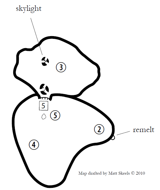
Numerous smaller articles were added to this guidebook, including content on the LTB system, Potholes, Derrick, and the Sandy Glacier Cave Project. The main addition, and a featured trip at that regional event, was the Horse Lava Tube System. This 32 page article is my compromise for never having completed the book I wanted to do on the system. By the time this guidebook rolled around, my enthusiasm for tackling the HLTS book project had waned, so I threw in all of my completed maps, wrote up that article and called it a day. Many new maps are included, as well as rare reprints of Larson’s maps from the system, typically only available in the 1982 NSS Guidebook and Speleograph newsletters.

The Horse system article includes a huge backlog of never before published maps. They include Mushroom, Pop & Son, McKnight, dozens of spatter cone caves, Stairstep, Barking Dog, Dos Liebres, Covet Caves, Pronghorn Caves, and new maps of select Redmond caves. Other new maps: Lilly, Scat, Three Eyes, More or Less, Lake Billy Chinook, China Hat Road Pit, Lunch, Catbegone, Standing Arches, a new Malheur Cave map (one of Larson’s last contributions to this realm), a modified McKenzie Pits map, Duo Pits, as well as other rarely published maps.

Strangely, the one map not included in this book, is the joint WVG/OG surface and cave survey of Paulina Crack. One of the caves, Fissure De Jour, is depicted on the cover. Maybe in a future guidebook?

Post Edit: 9.5.2019

2019RegionalGuidebook

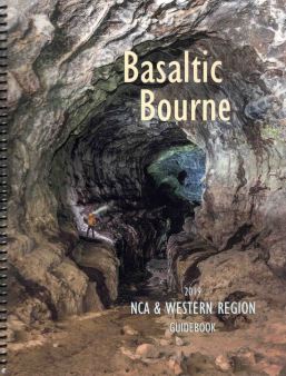
Basaltic Bourne, 2019 NCA & Western Region Guidebook edited by Matt Skeels, cover photo by Brent McGregor

In 2019 the Oregon High Desert Grotto and the Oregon Grotto co-hosted the 2019 NCA & Western Region event in Redmond, Oregon. This guidebook only had 53 copies made and featured 100 pages of smooth, glossy articles and maps. The laminated cover depicts Kara Mickaelson in Derrick Cave.

Articles include Causeway of the Volcanoes by Michael Partridge, Mount Bachelor Volcanic Chain (MBVC) by Matt Skeels, a lidar-derived geologic map of the Mount Bachelor Volcanic Chain (MBVC) by Matt Skeels, and The Derrick Lava Tube System by Matt Skeels. The Derrick article received a few corrections to its previous printing in The Middle Ground.

The guidebook features many of your staple maps of central Oregon, with special emphasis on the MBVC area. Plenty of new or rarely published maps also got published. Including maps of Pictograph, Hyphenated and Charcoal Cave by Larry King, Smorgasbord by Michael Partridge, Bone Tunnel Cone, Ventana, and Hitch Digger by Edd Keudell, Carburetor by Garry Petrie, Dutchman I and II, Sparks Lake, and Independence by Ric Carlson, Pronghorn Lodge Cave by Ron Delano, Paulina Crack by Tom Kline, and more. I also drafted a few new maps, mostly sketches. Some new surveys were also included as well as a hefty dose of modified versions of previous maps both of my work and others. A few maps of mine that were included: The Grove, Battle Axe Mountain, Crooked River Indian, High on the Saddle, Mad Skills, Last Call, Cricket Town, Jaws, Alpine Ranch and more.

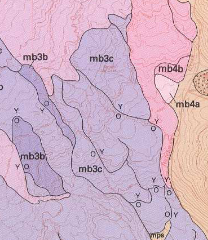
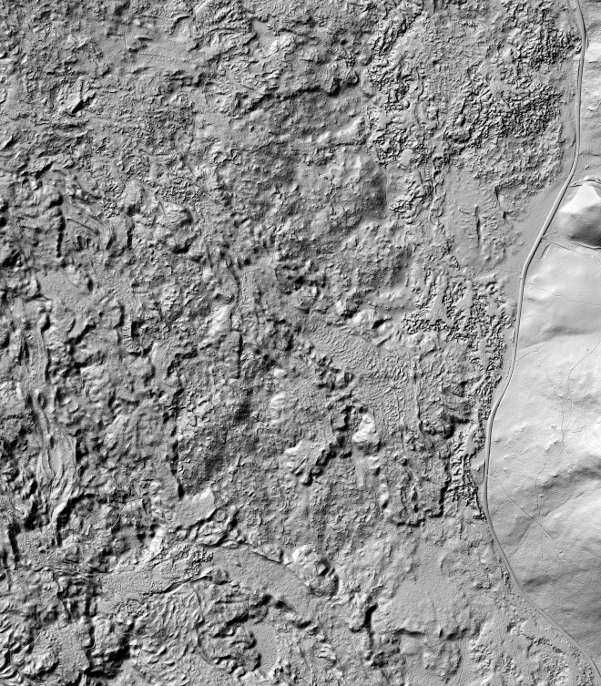
While there are only three articles in this book, the centerpiece is the 30 page article on the MBVC that describes in detail most of the known caves in that area. With the advent of lidar, numerous caves have been discovered and added to our growing list of lava tubes. The most interesting guidebook piece is a lidar-based geologic map of the MBVC that revises the 1992 geologic map by William E. Scott and Cynthia A. Gardner of the USGS. The new map improves upon the 1992 map, identifies new areas of interest, as well as key areas of uncertainty.  A presentation at the regional event explored some of the nuances of making a lidar-based map and identifying subtle lava features to constrain lava flows.

*******

Horse Lava Tube System Bibliography by Matt Skeels

I’m cheating a bit here, since this book has not been published yet, but a near final draft exists. It’s been cited as a source exactly twice: once in my work done for the Oregon Department of State Lands and the other in The Middle Ground. For now, it is strictly an electronic document. Always a work-in-progress, I constantly updated the document as I uncovered new morsels of information in my research. As of late, work has stopped and articles to review have all but dried up. A few internet articles could still be reviewed in the future.

This dry, but information rich document,  is a 100+ page bibliography. In it, I’ve reviewed… doing some rough guesstimating in my head here… around 500 sources of information that mention the Horse system. I list the name of each source and give a detailed summary with review, correcting the authors if they’ve made a mistake, as well as supplementing my own information when the source is lacking.

In the future, I hope to reorganize the book, but that may be too large of an undertaking. I may just have to hope for a final review, fill in a few blanks, and publish a limited number of hard copies to gift out to friends and to those who contributed to my research. If that happens, I guarantee it is essential literature for central Oregon cavers, just not for beginners.


The fabled 17 mile lava tunnel from Bend to Redmond

A few years ago, I stopped at a random house asking about caves in the neighborhood. The fellow I spoke to was a friendly chap and had no information to offer, but he did have a question for me. He asked “I heard that the military base east of Bend on Dodds road was built on a lava tube that runs all the way to the Redmond airport. Do you know anything about that?”

The military base he was referring to is the Oregon National Guard Youth Challenge Program high school on Dodds rd. I don’t know if it is built on a lava tube, but it’s surely possible, just as it is for nearly any other building in central Oregon to unknowingly be built over a lava tube. There are plenty that are. But somehow that old rumor that Bend is connected to Redmond via a 17 mile lava tube had morphed into a secret military access route to the airport.

It’s suspected that the rumor began during the prohibition era when a few locals were known to have illegally distilled liquor in a few caves around the Bend area. Remnants of these operations were found in Skeleton Cave, Distillery Cave, and Moonshiner’s Cave. But only Skeleton Cave is of any sufficient length to be even remotely considered as the basis for this rumor, and as we know today, Skeleton Cave is not quite a mile in length.

An old distillery barrel in Moonshiner’s Cave.

News stories in the Bend Bulletin would later remark on the rumors. The first known mention “Tunnels Under Bend” (p. 4) occurred in 1940 after a fellow offered up a story of a 17 mile long tunnel used for shipping alcohol. The editor of the article, most likely Phil Brogan, rightly denounced the plausibility of such a fanciful tale citing no evidence. However, he does note that fissures underlie the landscape. Still, it’s hard to imagine an uninterrupted 17 mile long fissure running north to Redmond, when most of the faults in the area are not fissures but merely fault scarps and run generally SE/NW.

Another brief article made the front page of the Bend Bulletin, titled “Impressions of central Oregon visitors” (p. 1). A visitor asks the pervasive question about the two cities being connected by a cave the size of a subway tunnel. This myth is rebuffed too and the editor again suggests fissures, the odd cavern or two, and a subterranean stream. In 1958, another article “Cavern Explorers” (p. 4) briefly mentions the rumor that did not die.

The longest lava tube in Oregon is still Lava River Cave. A little over a mile long, it is the perfect example for when conditions are right, this lava tube still could not live up to the tall tales of the prohibition era. The city of Bend is underlain with the same lava rock that created the Lava River Cave and this flow nearly extends to the city of Redmond. Some caves have been found underneath, but there’s very little chance that these caves developed unbroken channels 17 miles long. Or that the roofs did not collapse and segment these caverns. If a cave of such mythical proportions did exist, it’d still be easier to ship the illegal moonshine on the surface even with the risk of being caught.

Entering the nether world

My maiden blog post! As the editor of the Oregon Underground, the newsletter of the local caving club in central Oregon, it will be challenging to not duplicate efforts between that venue and this one. The newsletter will have the crème de la crème: the cave maps, the best pictures, the grittiest details, and exclusive articles from a variety of authors. But it doesn’t get published as much, so this blog will shine in ways that it cannot.

But just how will this blog differ? In quantity. Many of my excursions that go undocumented will find a home here. Aside from exclusive content in the form of trips and pictures, I hope to have video too. More musings, more snippets, more history, more of just about everything. Maybe even non-cave related items?

MyceliumNyhl

My son Nyhl in Mycelium Cave

What will this blog not be?

Another position I have with the Oregon High Desert Grotto is that of webmaster. From time to time, I get emails that ask for cave locations. Unfortunately, I have to refuse every single request.  You see, most cavers (that’s what we call ourselves) operate under a kind of secrecy. That is, we don’t reveal cave locations. It’s not that we are jerks or selfish. But it serves to protect the caves from the wrong-doers, and the good-intentioned from themselves. Caves are a delicate thing and can easily be harmed beyond repair. On the flip side, spelunkers who wander into a cave unprepared can hurt themselves by not being properly equipped with the right gear.

We are entering a new phase with our culture as it continues to harness the power of the internet. Everything that cavers hold dear is at risk. All kinds of information is becoming accessible and it won’t be long before all those secret caves become more visible and accessible with just a click of the finger. If the average joe can go online and find coordinates to a cave, there is no need for him to contact his local grotto. This is the threat all grottos must face in the future lest they become an afterthought. Cave location secrecy is still an effective management policy, just not a foolproof one. I intend to employ it here and strongly urge anyone interested in caving to contact their local grotto to learn more. Click on the “About” page above for a link to the Oregon High Desert Grotto website.

One of the ways I plan to help cave management is by reversing the lack of education the general public has on caves. The status quo has come about through a modus operandi of decades of secrecy. This secrecy has not brought caves into visibility as a resource that needs to be protected. Secrecy has been a double-edged sword. But those days are quickly coming to an end. So it falls on all cavers to begin to educate the public as to why caves need protection and the proper way on how to do that.

In my case, I hope to foster a love and respect for caves through this blog. This may bring new responsibilities to local grottos and I hope that they will rise to the challenge of training new enthusiasts and create a new generation of cave caretakers.